|
Topographic Maps of the Yuma, Arizona AreaSeptember 9, 2007 |
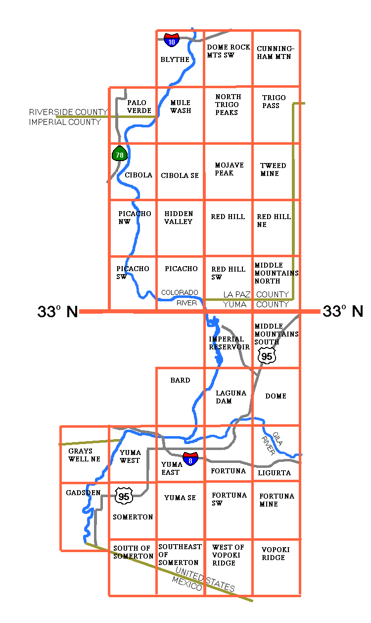
This collection contains images of some 7.5-minute USGS topographic maps of the Yuma, Arizona Area.
To find the desired image, look on the layout map below.
To view an image, click on the name of the map in the list at the end of this page. CAUTION: Most versions of Windows Internet Explorer won't display these images because they are too large. If you have this problem, download the image and use your favorite image software (or the Windows Picture and Fax Viewer) to view it. Or you can download the Mozilla Firefox browser from www.mozilla.com.
If your browser does clickable maps, you can also view an image by clicking on it in the layout map.
To download an image, right-click on the name and select "Save Link" or "Save Target" from the context menu.
The scale of the images is approximately 660 pixels per mile.
The images for this collection were downloaded in 2007 from the Internet Archive, modified slightly, and saved in GIF format. The modifications were as follows:
The map formats and organization are changed from time to time. The processing required for downloads may be different in the future. The Internet Archive is not very well organized; finding a map usually requires the use of the archive's search engine.
The USGS topographic maps, the downloaded images, and the images in this collection are all in the public domain. You may use them for any legal purpose without permission or royalties. Although the maps are generally quite accurate, many of them are significantly out of date.
Philip J. Erdelsky
pje@efgh.com
www.alumni.caltech.edu/~pje