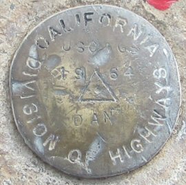
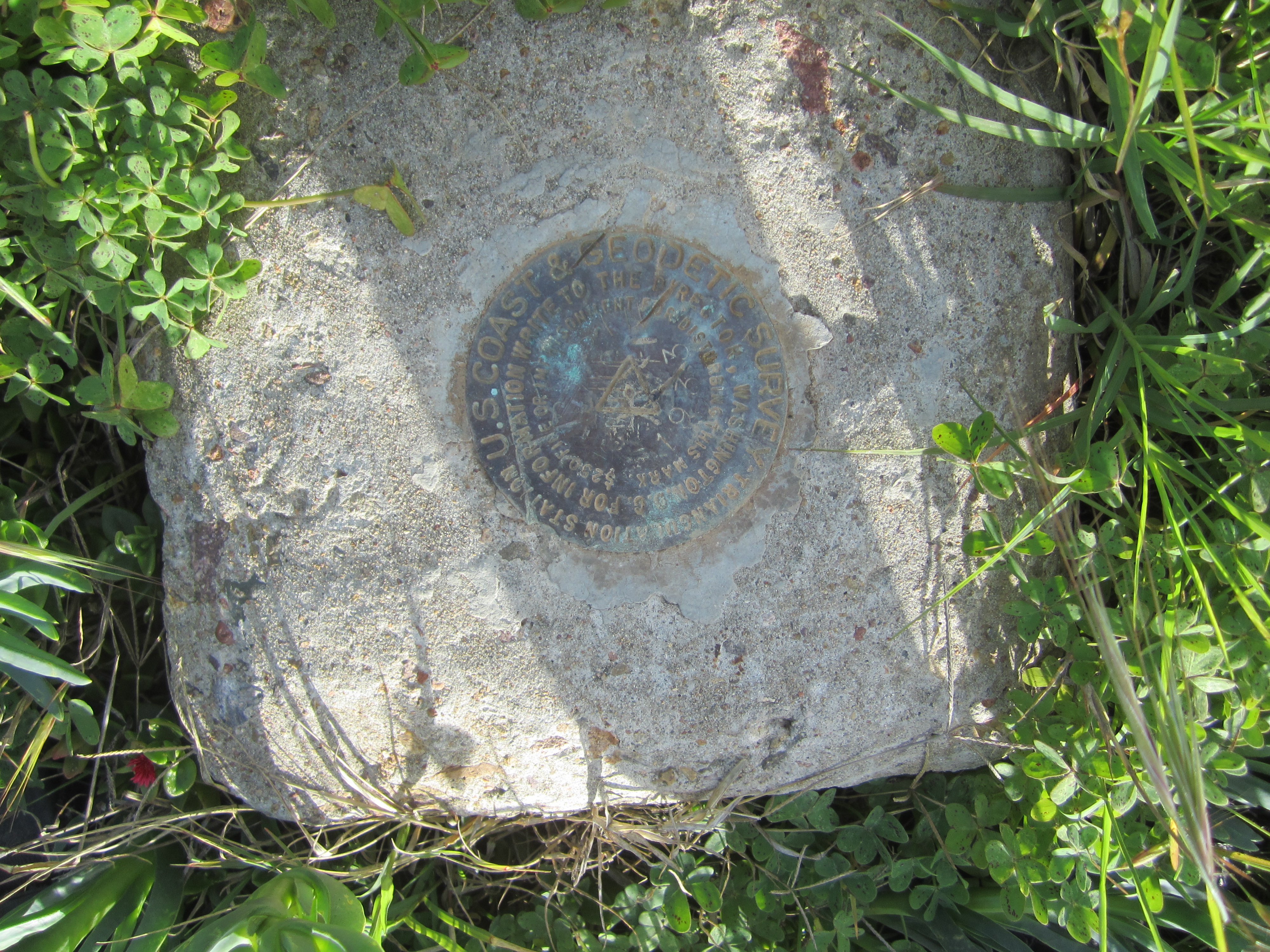
Name:        DAN
Identifier:  DC1735
Lat/Lon:     N 32° 42.590 W 117° 8.237
Elevation:   206 FEET
Year:        1964
Address:     GRANT HILL PARK, 2640 J ST, SAN DIEGO CA 92102
Vicinity:    click here
Survey Date: 1/19/2014
Description: click here
Page 1 of 7 | next page
|
| Name: DAN Identifier: DC1735 Lat/Lon: N 32° 42.590 W 117° 8.237 Elevation: 206 FEET Year: 1964 Address: GRANT HILL PARK, 2640 J ST, SAN DIEGO CA 92102 Vicinity: click here Survey Date: 1/19/2014 Description: click here |
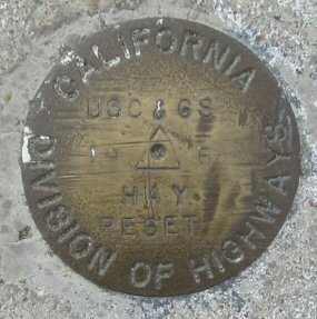
| Name: HAY Identifier: DC1746 Lat/Lon: N 32° 43.494 W 117° 11.673 Elevation: 44 FEET Year: 1968 Address: 835 HARBOR ISLAND DR, SAN DIEGO CA 92101 Vicinity: click here Survey Date: 1/21/2014 Description: click here |
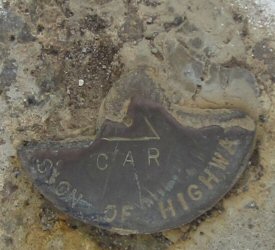
| Name: CAR Identifier: DC1459 Lat/Lon: N 32° 46.990 W 117° 3.188 Elevation: 696 FEET Year: Address: 6629 NORMAN LN, SAN DIEGO CA 92120 Vicinity: click here Survey Date: 1/21/2014 Description: click here |

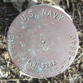
| Name: JET Identifier: Lat/Lon: N 32° 44.784 W 117° 7.347 Elevation: 340 FEET Year: Address: 3775 BOUNDARY ST, SAN DIEGO CA 92104 Vicinity: click here Survey Date: 1/23/2014 Description: click here |
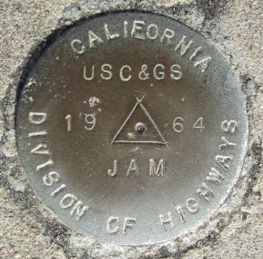
| Name: JAM Identifier: DC1555 Lat/Lon: N 32° 43.912 W 117° 7.046 Elevation: 313 FEET Year: 1964 Address: 2505 BOUNDARY ST, SAN DIEGO CA 92104 Vicinity: click here Survey Date: 1/23/2014 Description: click here |
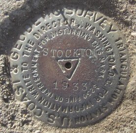
| Name: STOCKTON Identifier: DC1490 Lat/Lon: N 32° 45.425 W 117° 11.651 Elevation: 160 FEET Year: 1938 Address: PRESIDIO DR AT COSOY WAY, SAN DIEGO CA 92103 Vicinity: click here Survey Date: 1/21/2014 Description: click here |
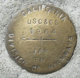
| Name: JAW Identifier: DC1495 Lat/Lon: N 32° 45.796 W 117° 7.706 Elevation: 378 FEET Year: 1964 Address: 4720 BOUNDARY ST, SAN DIEGO CA 92116 Vicinity: click here Survey Date: 1/27/2014 Description: click here |
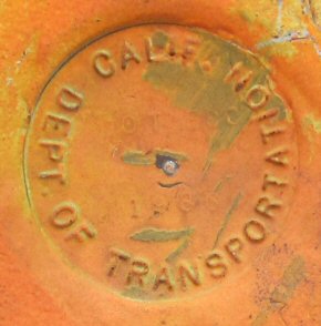
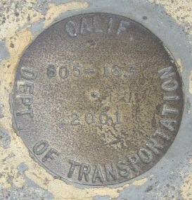
| Name: DOT Identifier: DC1569 Lat/Lon: N 32° 43.021 W 117° 6.698 Elevation: 182 FEET Year: Address: 3846 C ST, SAN DIEGO CA 92102 Vicinity: click here Survey Date: 1/26/2014 Description: click here |
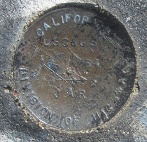
| Name: JAR Identifier: DC1570 Lat/Lon: N 32° 38.757 W 117° 2.877 Elevation: 362 FEET Year: 1964 Address: 420 MOON VIEW DR, CHULA VISTA CA 91910 Vicinity: click here Survey Date: 1/28/2014 Description: click here |
| Name: 805-16.3 Identifier: Lat/Lon: N 32° 45.232 W 117° 7.497 Elevation: 368 FEET Year: 2001 Address: 3201 ORANGE AVE, SAN DIEGO CA 92104 Vicinity: click here Survey Date: 2/2/2014 Description: click here |
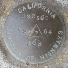
| Name: JOB Identifier: DC1474 Lat/Lon: N 32° 45.296 W 117° 7.537 Elevation: 392 FEET Year: 1964 Address: 4270 BOUNDARY ST, SAN DIEGO CA 92104 Vicinity: click here Survey Date: 2/2/2014 Description: click here |
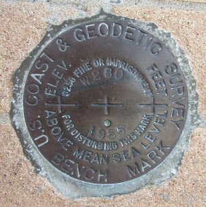
| Name: W280 Identifier: DC0860 Lat/Lon: N 32° 44.127 W 117° 9.627 Elevation: 275 FEET Year: 1955 Address: 2870 FIFTH AVE, SAN DIEGO CA 92103 Vicinity: click here Survey Date: 2/3/2014 Description: click here |
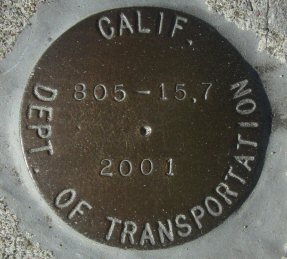
| Name: 805-15.7 Identifier: Lat/Lon: N 32° 44.764 W 117° 7.197 Elevation: 297 FEET Year: 2001 Address: 3425 LANDIS ST, SAN DIEGO CA 92104 Vicinity: click here Survey Date: 2/5/2014 Description: click here |

| Name: ALAMEDA Identifier: DC0779 Lat/Lon: N 32° 41.971 W 117° 10.976 Elevation: 11 FEET Year: 1939 Address: 301 ALAMEDA BLVD, CORONADO CA 92118 Vicinity: click here Survey Date: 2/4/2014 Description: click here |
| Name: Identifier: Lat/Lon: N 32° 35.594 W 117° 7.341 Elevation: 18 FEET Year: Address: Vicinity: click here Survey Date: 2/4/2014 Description: click here |
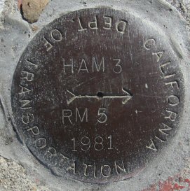
| Name: HAM 3 Identifier: DC1556 Lat/Lon: N 32° 38.151 W 117° 5.941 Elevation: 38 FEET Year: 1981 Address: 793 F ST, CHULA VISTA CA 91910 Vicinity: click here Survey Date: 2/4/2014 Description: click here |
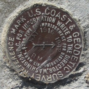
| Name: NAT Identifier: DC1562 Lat/Lon: N 32° 39.507 W 117° 6.885 Elevation: 13 FEET Year: 1916 Address: 1290 BAY MARINA DR, NATIONAL CITY CA 91950 Vicinity: click here Survey Date: 2/4/2014 Description: click here |
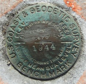
| Name: Identifier: Lat/Lon: N 32° 40.489 W 117° 6.895 Elevation: 9 FEET Year: 1944 Address: 600 E HARBOR DR, NATIONAL CITY CA 91950 Vicinity: click here Survey Date: 2/4/2014 Description: click here |
| Name: BASIN Identifier: DC1629 Lat/Lon: N 32° 35.424 W 117° 6.893 Elevation: 23 FEET Year: 1933 Address: 401 8TH ST, IMPERIAL BEACH CA 91932 Vicinity: click here Survey Date: 2/4/2014 Description: click here |
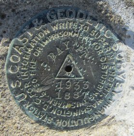
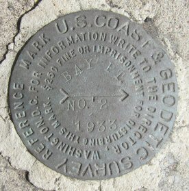
| Name: BAY PT Identifier: DC1025 Lat/Lon: N 32° 46.795 W 117° 14.210 Elevation: 24 FEET Year: 1933 Address: 3310 RIVIERA DR, SAN DIEGO CA 92109 Vicinity: click here Survey Date: 2/7/2014 Description: click here |
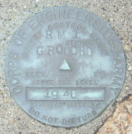
| Name: GROUCHO RM 1 Identifier: DC2119 Lat/Lon: N 32° 59.213 W 116° 52.678 Elevation: 1708 FEET Year: 1940 Address: 1500 DEVINEY LANE, RAMONA CA 92065 Vicinity: click here Survey Date: 2/10/2014 Description: click here |
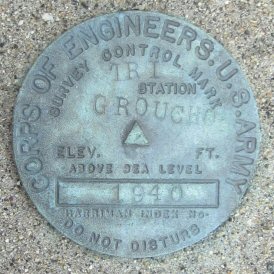
| Name: GROUCHO TRI Identifier: DC2119 Lat/Lon: N 32° 59.213 W 116° 52.674 Elevation: 1706 FEET Year: 1940 Address: 1500 DEVINEY LANE, RAMONA CA 92065 Vicinity: click here Survey Date: 2/10/2014 Description: click here |
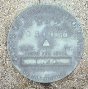
| Name: GROUCHO RM 2 Identifier: DC2119 Lat/Lon: N 32° 59.218 W 116° 52.669 Elevation: 1702 FEET Year: 1940 Address: 1500 DEVINEY LANE, RAMONA CA 92065 Vicinity: click here Survey Date: 2/10/2014 Description: click here |
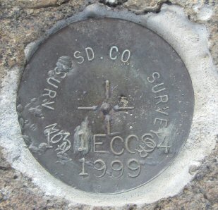
| Name: Identifier: Lat/Lon: N 32° 59.724 W 116° 51.489 Elevation: 1543 FEET Year: 1999 Address: 1500 DEVINEY LANE, RAMONA CA 92065 Vicinity: click here Survey Date: 2/10/2014 Description: click here |
| Name: BAY PT NO 2 Identifier: DC1026 Lat/Lon: N 32° 46.801 W 117° 14.208 Elevation: 89 FEET Year: 1933 Address: 3311 RIVIERA DR, SAN DIEGO CA 92109 Vicinity: click here Survey Date: 2/12/2014 Description: click here |