|
Park Trail MapsOctober 22, 2015 |
Please E-mail comments, corrections and additions to the webmaster at pje@efgh.com.
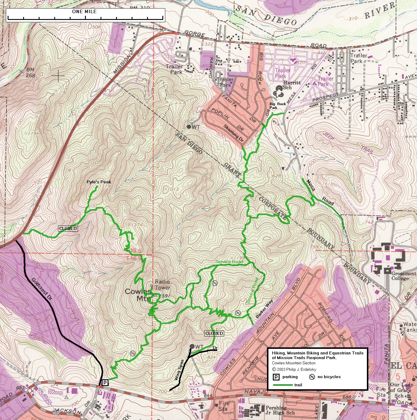
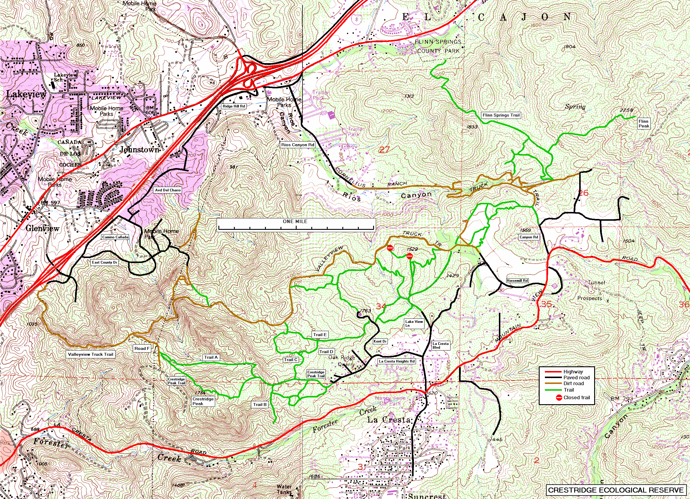
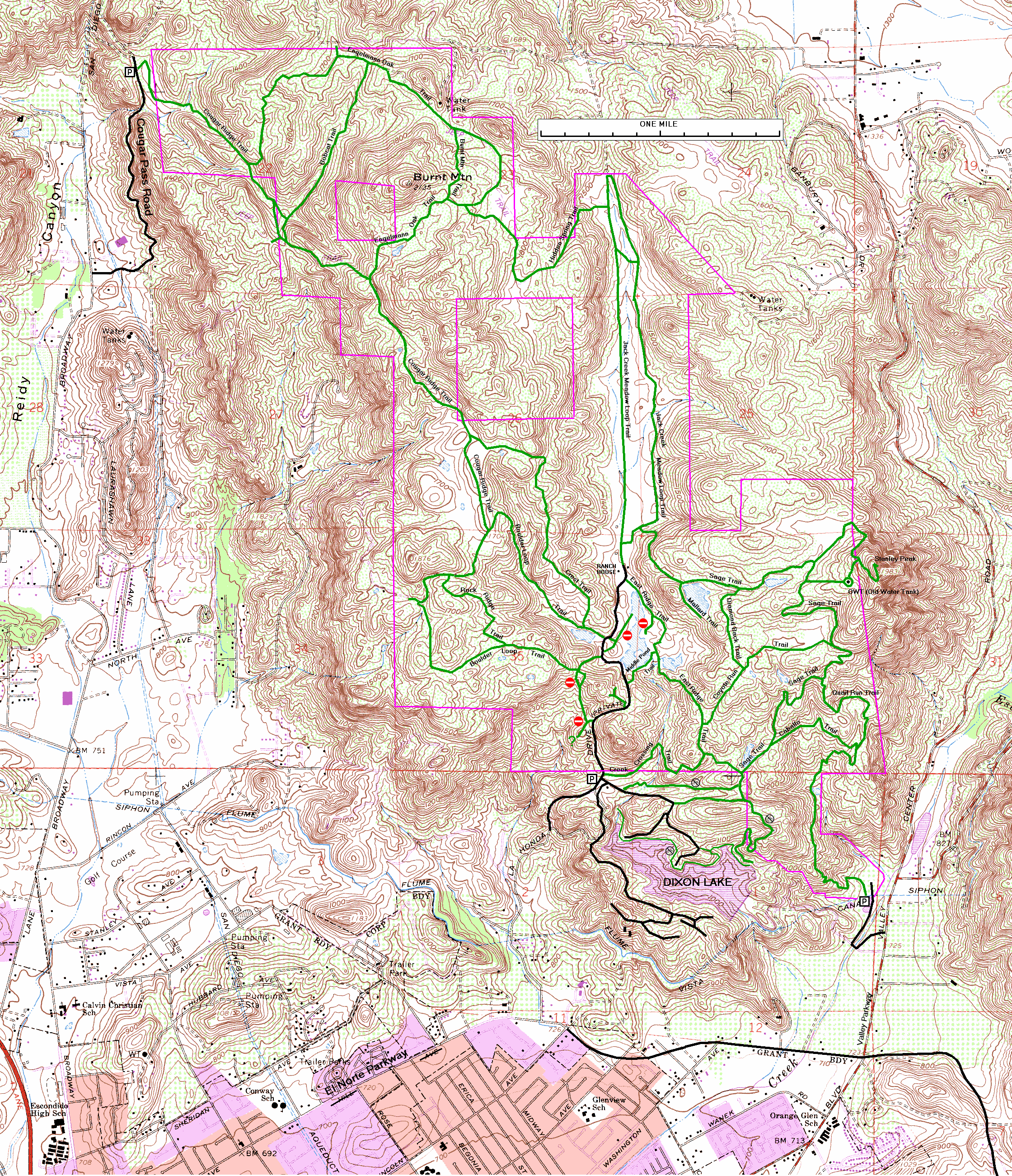
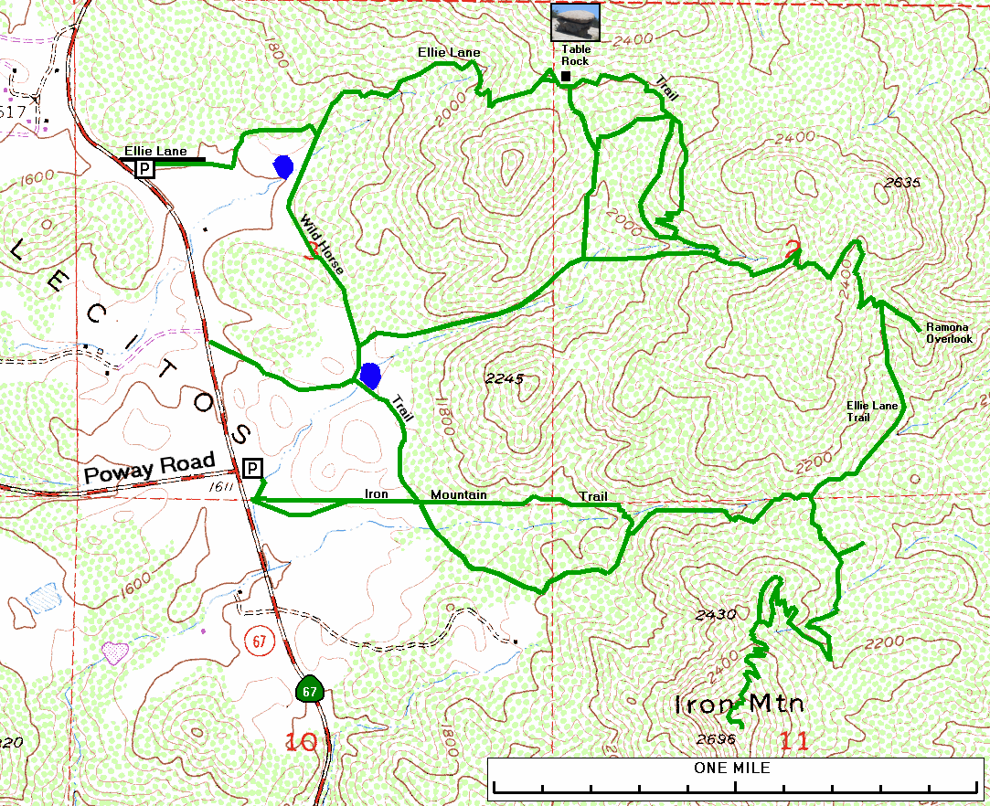
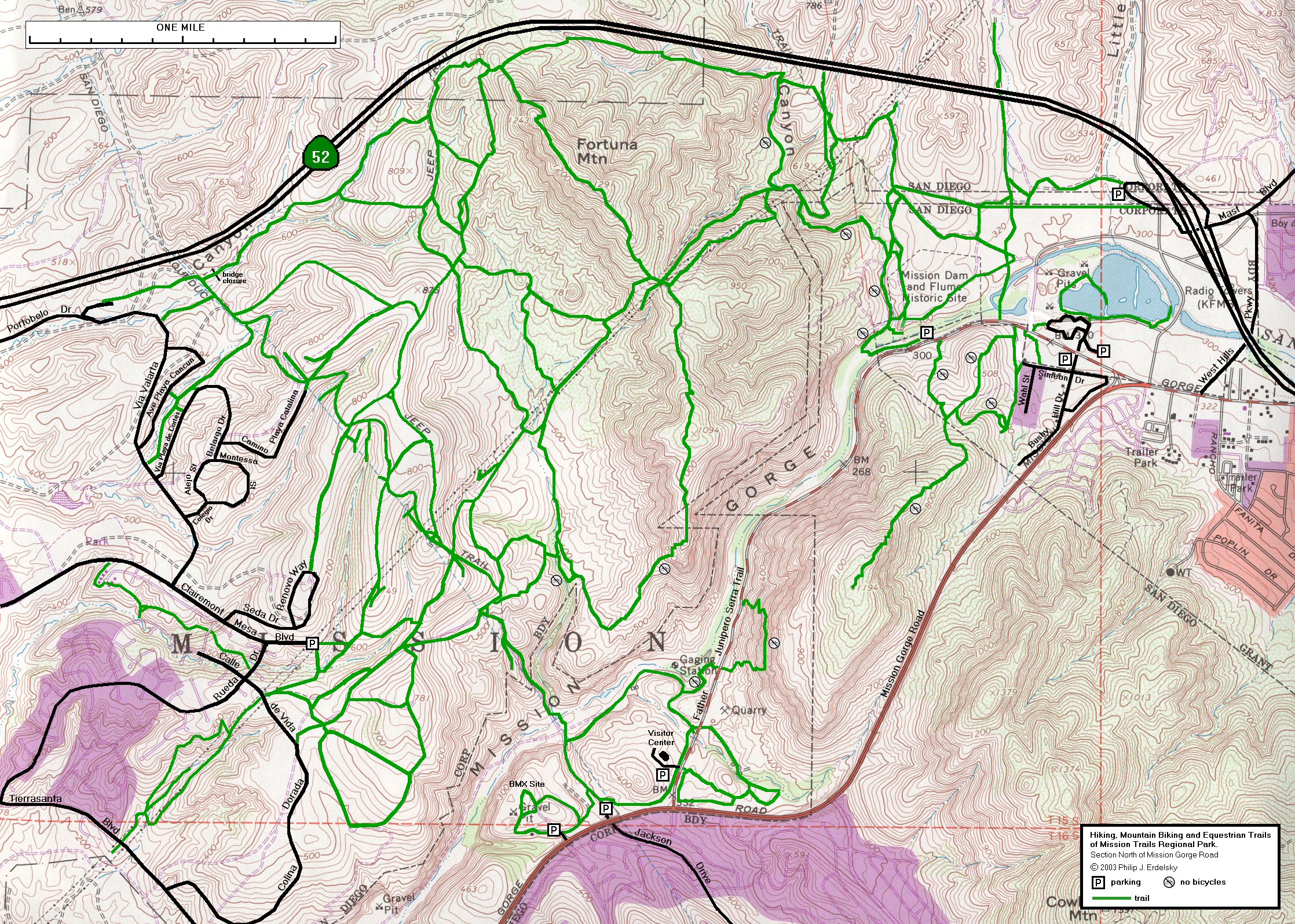
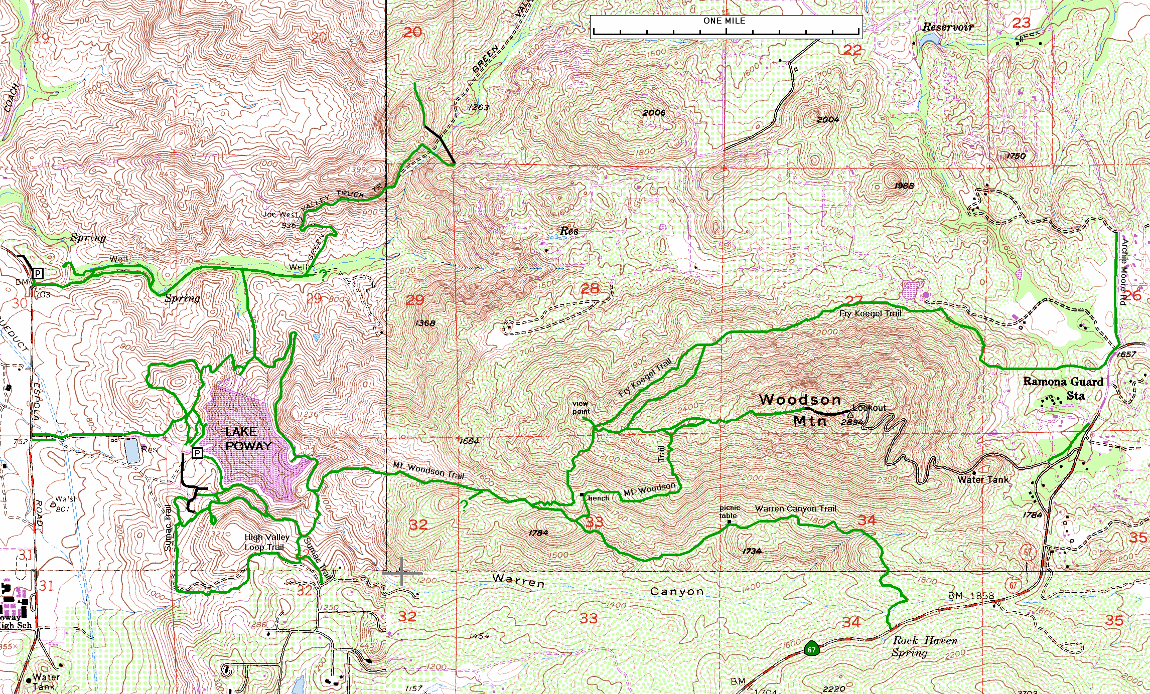
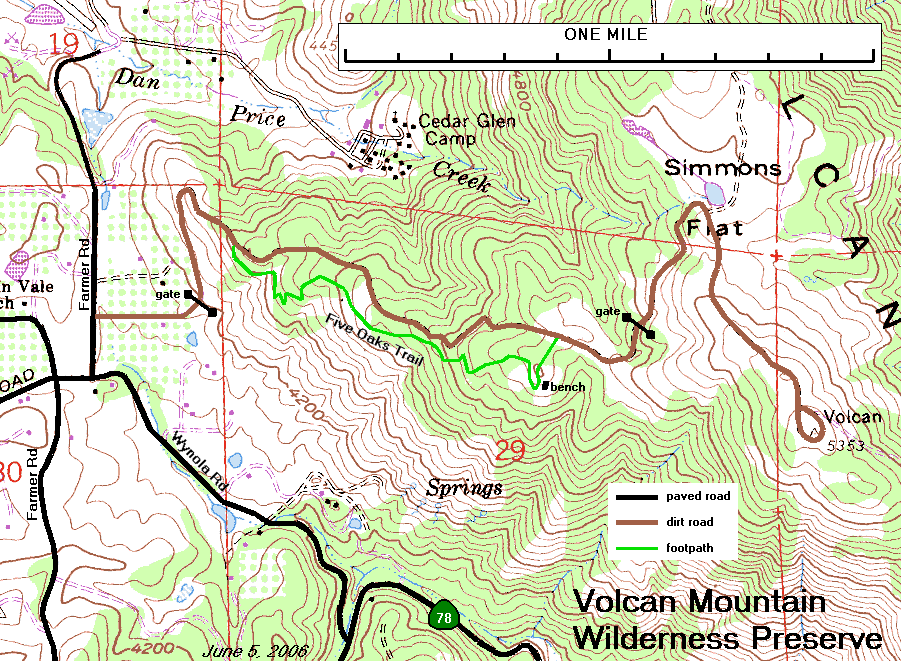
I have compiled trail maps of some local, county and state parks in San Diego County. They are USGS topographic maps, overlaid with trail maps and other information.
The following maps have been posted:
Some of these maps are not quite up-to-date. I am making changes from time to time as I explore the trails. Feedback from users is welcome.
All of these maps have the same scale: 528 pixels per mile. Generally, trails and roads are color-coded. Paved roads are black (or red for some major roads), unpaved roads are brown, and trails are green. The difference between an unpaved road and a trail is not always obvious, because many trails used to be fire roads.
Philip J. Erdelsky